宇航员能在月球上使用GPS导航吗?
an Astronauts Use GPS to Navigate on the Moon? NASA Scientists Say Yes
宇航员能在月球上使用GPS导航吗?答案是肯定的
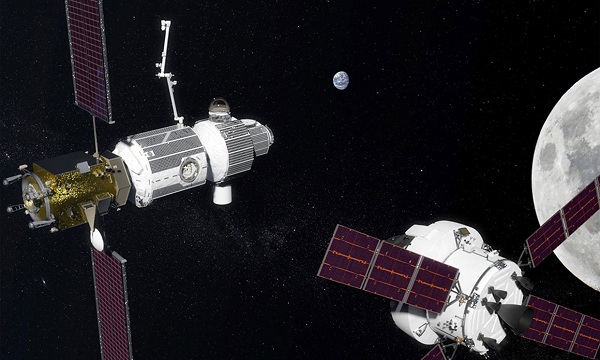
插图:美国宇航局
Scientists say lunar explorers could ‘see’ enough Earth-orbiting satellites to make an expensive new system unnecessary.
科学家说,月球探测器可以“看到”足够多的地球轨道卫星,从而使昂贵的新探测系统成为不必要。
If astronauts reach the moon as planned under NASA’s Project Artemis, they’ll have work to do. A major objective will be to mine deposits of ice in craters near the lunar south pole—useful not only for water but because it can be broken down into hydrogen and oxygen. But they’ll need guidance to navigate precisely to the spots where robotic spacecraft have pointed to the ice on the lunar map. They’ll also need to rendezvous with equipment sent on ahead of them such as landing ships, lunar rovers, drilling equipment, and supply vehicles. There can be no guessing. They will need to know exactly where they are in real time, whether they’re in lunar orbit or on the moon’s very alien surface.
按美国宇航局(NASA)阿尔忒弥斯登月计划,宇航员登月将有许多工作要做。一个主要目标将是在月球南极附近的陨石坑中挖掘冰的沉积物,这不仅对采集水有用,而且因为它还可以分解成氢和氧。但他们需要指引才能精确地将太空飞船导航至月球地图上冰层所在之处。他们还需要与之前发送的登陆舰、登月车、钻井设备和补给车等设备会合。毋容置疑,无论是在月球轨道上还是在十分陌生未知的月背,他们都需要实时准确地知道自己的位置。
Which got some scientists thinking. Here on Earth, our lives have been transformed by the Global Positioning System, fleets of satellites operated by the United States and other countries that are used in myriad ways to help people navigate. Down here, GPS is capable of pinpointing locations with accuracy measured in centimeters. Could it help astronauts on lunar voyages?
这引起了一些科学家的思考。在地球上,全球定位系统已改变了我们的生活。由美国和其他国家运营的卫星群以多种方式帮助人们导航。在地球上,GPS定位能够精确到厘米。那么,它能帮助宇航员在月球上导航吗?
Kar-Ming Cheung and Charles Lee of NASA’s Jet Propulsion Laboratory in California did the math, and concluded that the answer is yes: Signals from existing global navigation satellites near the Earth could be used to guide astronauts in lunar orbit, 385,000 km away. The researchers presented their newest findings at the IEEE Aerospace Conference in Montana this month.
(美国)加州宇航局(NASA)喷气推进实验室的张嘉明(Kar-Ming Cheung)和李查理(Charles Lee)进行了数学计算,总结得出的答案是:来自地球附近现有的全球导航卫星信号可以用来引导385,000公里外的月球轨道上的宇航员。研究人员于本月在蒙大拿州电气和电子工程师学院举行的航空航天大会上介绍了他们的最新发现。
“We are trying to get it working, especially with the big flood of missions in the next few years,” said Cheung. “We have to have the infrastructure to do the positioning of those vehicles.”
李查理说“尤其是在接下来几年里还有一堆任务的情况下,我们正努力尝试让其变得可行,我们必须有基础设施来定位这些(在月球上工作的)各种车、舰设备。”
Cheung and Lee plotted the orbits of navigation satellites from the United States’s Global Positioning System and two of its counterparts, Europe’s Galileo and Russia’s GLONASS system—81 satellites in all. Most of them have directional antennas transmitting toward Earth’s surface, but their signals also radiate into space. Those signals, say the researchers, are strong enough to be read by spacecraft with fairly compact receivers near the moon. Cheung, Lee and their team calculated that a spacecraft in lunar orbit would be able to “see” between five and 13 satellites’ signals at any given time—enough to accurately determine its position in space to within 200 to 300 meters. In computer simulations, they were able to implement various methods for improving the accuracy substantially from there.
张和李绘制了美国全球定位系统和欧洲伽利略及俄罗斯GLONASS系统的导航卫星轨道图,共计81颗卫星。它们中的大多数都有向地球表面发射的定向天线,其信号也辐射到太空。研究人员说,这些信号足够强,可以被靠近月球接收器相当紧凑的航天器读取。张和李及其团队计算出,在月球轨道上的航天器将能够在任何特定时间接收到 5至13颗卫星信号,能够精确确定其在200至300米范围内的空间位置。在计算机模拟中,他们能够从那里实施各种方法来提高精确度。
Helping astronauts navigate after landing on the moon’s surface would be more complicated, mainly because in polar regions, the Earth would be low on the horizon. Signals could easily be blocked by hills or crater rims.
登月后帮助宇航员导航会更加复杂。这主要是因为在极地地区,地球处于水平线以下,信号很容易被丘陵或火山口边缘挡住。
But the JPL team and colleagues at the Goddard Space Flight Center in Maryland anticipated that. To help astronauts, the team suggested using a transmitter located much closer to them as a reference point. Perhaps, the scientists wrote, they could use two satellites in lunar orbit—a new relay satellite in high lunar orbit to act as a locator beacon, combined with NASA’s Lunar Reconnaissance Orbiter, which has been surveying the moon since 2009.
但是,马里兰州戈达德航天飞行中心的JPL团队和同事预计到了这点。为了帮助宇航员,研究小组建议使用距离他们更近的发射器作为参考点。科学家阐述,也许他们可以使用月球轨道上的两颗卫星,一颗在高月轨道上的新中继卫星,再加上美国宇航局( NASA)自2009年以来一直在对月球进行探测的“月球侦察轨道卫星”作为定位信标。
This mini-network need not be terribly expensive by space-program standards. The relay satellite could be very small, take design cues from existing satellite designs, and ride piggyback on a rocket launching other payloads toward the moon ahead of astronauts.
按照太空计划的标准,这种小型网络并不会非常昂贵。中继卫星可能很小,从现有卫星设计中汲取设计线索,先于宇航员搭载火箭发射其他有效载荷飞向月球。
The plans for Artemis have been in flux, slowed by debates over funding and mission architecture. NASA managers have been banking on a planned lunar-orbiting base station, known as the Gateway, to make future missions more practical. But if they are going to put astronauts on the surface of the moon by 2024, as the White House has ordered, they say the Gateway may have to wait until later in the decade. Still, scientists say early plans for lunar navigation will be useful, no matter how lunar landings play out.
由于对资金和任务架构的争论,阿耳忒弥斯计划一直在变化中。美国宇航局( NASA)的管理者们一直在为计划中的月球轨道基站即网关提供资金,以使未来的任务更具有可行性。但是,他们表示如果按照白宫的命令,要在2024年之前让宇航员登月,网关可能必须等到十年后。尽管如此,科学家们说,不管登月计划如何实施,早期的月球导航计划都是有用的。
“This can be done,” said Cheung. “It’s just a matter of money.”
张说: “这是可以实现的,不过就是钱的问题而已。”
《健康生活报道》编译中心
李轶伦翻译
https://spectrum.ieee.org/
By Ned Potter
Posted 17 Mar 2020